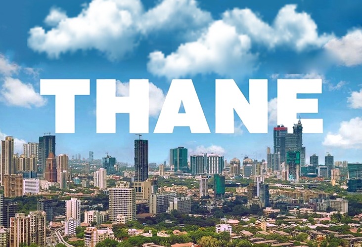
Learn about the Thane Development Plan (TDP) and how it helps shape and develop the city’s infrastructure and amenities. The plan aims to turn Thane into a thriving urban hub. Learn about Thane’s future as a new, modern urban hub.
Thane, one of the fastest-growing cities in the Mumbai Metropolitan Region (MMR), is quickly catching up. The Thane Development Plan (TDP) is critical for determining how the city’s infrastructure, housing, and urban landscape will look in the near future. The TMC develops plans on a regular basis to keep up with the city’s demands and difficulties. We will examine the fundamental components of the Thane Development Plan, lay out the main goals, and see how the structure will fit together in the future for Thane.
Latest News On Thane Development Plan
On October 14, 2024, the Thane Municipal Corporation (TMC) unveiled a draft of the city’s updated development plan, taking a step towards changing Thane’s appearance. It has advocated for more open spaces and recreational routes in the city, citing the city’s growing public space needs. The plan is being reviewed and will be discussed based on suggestions made by the public within the next 60 days.
The revised development plan, an updated version of the one from 1999, is now available for public viewing. The details can be found on the TMC website and at the municipal office’s headquarters.
Thane Development Plan 2026 – 2046
The Thane Development Authority announced the Thane Development Plan 2026-2046 in May 2021. It prepared a base map using Geographic Information System (GIS) technology until February 2022. It served as a critical foundation for the development of the existing land use data. These data were used to evaluate the Thane Municipal Corporation’s (TMC) implementation of the approved Development Plan.
Implementation Status of the Sanctioned Development Plan.
| Broad Area | Zoning Area (Ha) | Developed Area (Ha) | Percentage of Development (Implementation) |
| Development Plan Sites (Designated Sites) | 1,476 | 214 | 14.49% |
| Development Plan Roads | 1,182.25 | 400 | 33.83% |
| Residential Zone | 3,073 | 2,110.95 | 68.69% |
| Commercial Zone | 132 | 24 | 18.18% |
| Industrial Zone | 1,254 | 414 | 33.01% |
| Total | 7,117.25 | 3,162.95 | 44.44% |
Development Plans for Thane
Thane’s Development Plans will include facilities in a variety of sectors, such as:
Social Infrastructure
Educational Facilities: Schools, colleges, and vocational training facilities will be established.
Health and Medical Facilities: Hospitals and clinics will provide great healthcare.
Commercial Facilities: Retail stores, retail malls, hotels, marriage halls, and banks will all help to boost local business.
Recreational and Entertainment Facilities: Recreational and amusement facilities will include parks, sports complexes, and entertainment centers.
Tourism: Focus on entertainment tourism and restoration of historical sites.
Community Spaces: Libraries, study centers, cremation and burial grounds, and local markets will be established.
Transport and Communication
Thane is about to revamp its transport and communication infrastructure. This city has access to airports, the closest of which is Chhatrapati Shivaji Maharaj Airport, which is 23 kilometres away. The Navi Mumbai International Airport will be built 42 kilometres away, according to the newly approved Mumbai Metropolitan Region Plan 2034. Thane Railway Station currently serves over 600,000 people per day and connects major cities, including Bengaluru and Chennai, via the Central Railway, Diva – Panvel line, and Trans-Harbour line.
The Mumbai Metro project will significantly improve travel by connecting Wadala to Kasarvadavali, Thane to Bhiwandi, and Kalyan. The Inland Water Transport would connect Thane to Vasai, Kalyan, and Bhiwandi, making access easier. Additionally, key highways such as NH-3, NH-4, and Ghodbunder Road would improve intercity connectivity.
Economic Growth
The IT/ITES Special Economic Zone has been approved for development, operation, and maintenance to boost the technology sector. Coastal roads, metros, elevated roads, and bullet trains are among the city’s infrastructure projects aimed at improving connectivity and creating jobs.
Utilities and Services
Water Supply
Drainage and Sewerage
Urban Waste Disposal
Power Supply
Post Offices
Development Plan Implementation
The draft revised development plan will be for the year 2046, with an objective population of 4.65 million. The plan will be executed around three main areas:
Zoning: Dividing land into different uses.
Road Network: Creating an efficient road network.
Reservation Sites: Set aside land for public amenities.
While some land for new roads can be secured through residential development approval, acquiring land for social amenities and public utilities is more difficult. Here are some methods of land acquisition:
Urban Renewal Schemes: Rejuvenating existing areas.
Transferable Development Rights (TDR): Allowing landowners to relinquish their rights over other areas.
Accommodation Reservation Principle: Ensure that developers reserve land for public use.
Town Planning Schemes: Joint land-use plans.
Landowners receive payment for their land.
The final four methods can only be used within financial constraints. These approaches play an important role in the success of the development plan’s implementation.
Cost Of Development Plan Proposals
The cost of various aspects of the draft development plan has been estimated. These estimates are based on current rates from the Annual Statement of Rates (ASR). Here’s the breakdown of the costs:
Land Acquisition: Around Rs 20,093.54 crores for all proposed sites.
Development and Construction: About Rs 12,185.03 crores.
This comes to around Rs 32,278.57 crores for acquiring and developing the plots. The cost of road infrastructure is approximately Rs 15,559.31 crore. The total development cost would be approximately Rs 47,837.88 crores.
Implementing Town Planning Schemes
Using Transferable Development Rights (TDR) – The TDR allows the landowner to collect compensation in the form of building rights to build a specified amount of space within certain guidelines. TDR can help acquire reserved lands and roads, as well as compensate for old buildings that must be demolished to make way for new roads or public utility projects. Based on previous practices, TDR is expected to acquire at least 25% of reserved lands and 50% of land required for roads.
Implementing the Accommodation Reservation Concept – In this accommodation reservation concept, a portion of the reserved land can be developed and submitted to the planning authority instead of FSI. The balance of the land would remain in the owner’s possession, subject to all applicable laws. Based on previous precedents, it is expected that at least 25% of the reserved land will be recovered using this concept.
Monetary Acquisition of Land – The reserved land can be acquired through either monetary compensation or compulsory acquisition. This method allows for the acquisition of up to 10% of reserved land.
Implementation Through Resource Mobilisation
Development Charges: The funds will be used to support the development plan and were collected in accordance with the Maharashtra Regional and Town Planning Act of 1966.
Premium FSI: Developers can pay for an additional Floor Space Index (FSI), which generates funds for infrastructure development.
Government Schemes: Financial assistance is available through programs such as Smart City and AMRUT.
Implementation Through Urban Renewal Scheme
Cluster Development: Introduced in 2009 to benefit larger areas rather than individual small plots.
Addressing Issues: Addresses issues such as poor housing and traffic congestion.
Thane Plans: 45 urban renewal plans have been identified, with work beginning in Sector 3 of Kisan Nagar.
Partnerships: Agreements with CIDCO and MAHAPREIT facilitate development; reserved land can be accessed at no additional cost.
Overview of the Previous Development Plan (1986–2001)
The plan classified land into several categories: residential, commercial, industrial, public open space, recreational areas, transit lands, and agricultural land.
A survey was conducted to determine how the city was developing, with a few key objectives:
Identify the primary land use in each area.
Check out what amenities were available and where improvements were needed.
Map marsh and creek lands.
Identify vacant lands that could be reserved for public purposes.
Given how difficult each zone was coming up,
The city was divided into three zones for this study:
Thane’s inner limits encompass the city centre.
The west side is promoted by Sanjay Gandhi National Park and the Ulhas River.
Zones for transportation and infrastructure, such as roads and railways
A base map was created from aerial surveys that were completed in January 1987.
Town Planning Scheme (1959)
Thane Municipal Council introduced its first town planning scheme in 1959.
The scheme was notified in the year 1962
The scheme included the area lying between Old Agra Road and pipeline, bounded by Wagle Industrial Estate and Pokhran Road No.1.
It was proposed to implement 31 development proposals based on the approved development plan.
It was approved in January 1985.
It became operational in May 1985.
Final Thoughts on Thane’s Development Plan
The Thane Development Plan holds the key to implementing change for the betterment of the city. The plant will prioritise improved infrastructure, social amenities, and long-term growth. The plan also provides an opportunity for community feedback, which will help refine proposals to meet residents’ needs and expectations. Even though political discussions emphasise the importance of transparency in all decisions, the TDP will be successful in transforming Thane into a vibrant, developed, and modern city. The city will strike a balance between urban development and a high quality of life in the future.


